
SS United States reef deployment scheduled for November 12 off Destin-Fort Walton Beach
SS United States: the next chapter
A historic ocean liner is scheduled to become an artificial reef off Destin-Fort Walton Beach. What is planned, why it matters, and what still comes next.

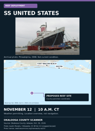
Archival photograph · Philadelphia, 2008. This is not the ship’s current condition. Photo: Austin Murphy, CC BY-SA 3.0. Full credits below.
The plan
Okaloosa County says deployment operations for the SS United States are scheduled to begin on Thursday, November 12. The county describes the project as the world’s largest artificial reef.
Why a reef?
The county says the project is intended to create marine habitat, add a diving destination and support the local and regional fishery. The vessel’s size and history are central to that plan.
Its project FAQ says the ship faced being sold for scrap after years of unsuccessful restoration and redevelopment efforts. Okaloosa County purchased it for reefing. The SS United States Conservancy is also developing a land-based Museum and Visitor Experience in Okaloosa County to preserve and interpret the ship’s history.
Where is it going?
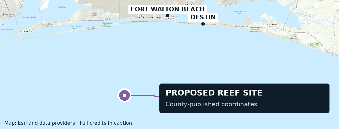
Proposed county coordinates: 30°07.148′ N, 86°46.755′ W. Overview only, not a navigation chart. Esri basemap; full data credits below.
Destin-Fort Walton Beach’s remediation update says the area was examined with multibeam sonar, side-scan sonar and visual bottom surveys to check for existing historical or natural resources that could be affected.
These surveys explain how the site was checked. The sources reviewed do not give a complete account of why it was chosen over every alternative.
Before the ship goes underwater
What could it mean locally?
Officials expect the reef to draw divers and anglers, with possible benefits for dive operators, fishing charters, lodging and restaurants. The county says the project is funded by tourism revenue and partner contributions; its FAQ identifies the county funding as short-term-rental bed-tax revenue, not general-fund revenue.
Ways to follow the sendoff
- November 11
- Public sendoff at 1:30 p.m. · Destin-Fort Walton Beach Convention Center
- November 12
- AJ’s Seafood and Oyster Bar, Destin · Live viewing party begins at 9 a.m.
- Deployment operations
- Scheduled to begin at 10 a.m. CT, weather permitting
- Watching from the water
- Follow guidance from safety boats at the deployment site.
Sources and image credits
Photo: “SS-United-States.jpg” by Austin Murphy, Philadelphia, 2008, via Wikipedia. Cropped and resized; the adapted photograph is shared under CC BY-SA 3.0.
Map: Esri World Topographic Map, created using Esri ArcGIS services. Sources: Esri, HERE, Garmin, Intermap, increment P Corp., GEBCO, USGS, FAO, NPS, NRCAN, GeoBase, IGN, Kadaster NL, Ordnance Survey, Esri Japan, METI, Esri China (Hong Kong), © OpenStreetMap contributors, and the GIS User Community. Reef point from the county’s release.