
Hurricane Isaias: Bay County watches, timeline and what to expect
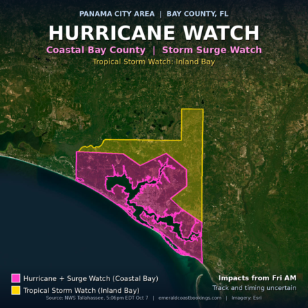
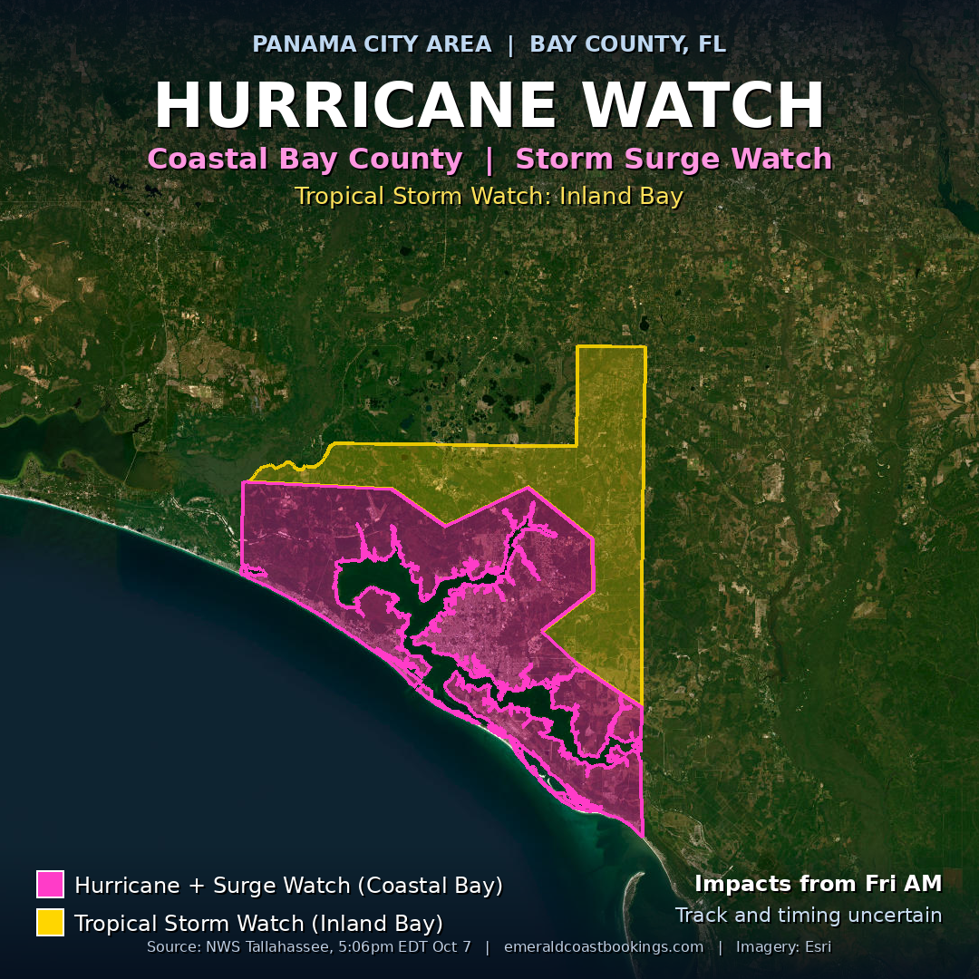
A Hurricane Watch and a Storm Surge Watch are in effect for Coastal Bay County. Inland Bay is under a Tropical Storm Watch. Isaias is quickly intensifying and is forecast to be a hurricane by Thursday morning.
Last updated Wednesday, October 7, 2026, 5:50 PM CT, using the NWS Tallahassee local statement issued 5:06 PM ET. The next local statement is expected around 11 PM ET, or sooner if conditions change. This page will be updated as the storm develops.
Watches for Bay County right now
- Coastal Bay: Hurricane Watch and Storm Surge Watch
- Inland Bay: Tropical Storm Watch
A watch means those conditions are possible in the area. It is not a warning. Nearby, the same statement lists a Hurricane Watch for Coastal Gulf, South Walton, Central Walton and North Walton, and a Tropical Storm Watch for Holmes and Washington counties.
Where the storm is
At 5 PM ET Wednesday, Tropical Storm Isaias was still in the Bay of Campeche, about 680 miles southwest of Panama City, with maximum sustained winds of 65 mph. It was moving east-northeast at 8 mph.
NWS Tallahassee says Isaias is forecast to turn north in the next day or so and speed up toward the central Gulf coast. Steady strengthening is expected over the next couple of days, though some weakening is possible just before landfall. The wind field is expected to grow considerably and may be lopsided toward the east, which could mean windier conditions for parts of the Panhandle.
The forecaster is clear that there is still considerable uncertainty with both timing and track.
Timeline
- Wednesday evening: Isaias still in the Bay of Campeche, 65 mph.
- Thursday morning: forecast to be a hurricane.
- As early as Friday morning: conditions could begin to deteriorate across the Panhandle.
- Friday into Saturday: NWS notes an elevated chance of tornadoes.
Exact landfall timing and location have not been set. Check back here and at weather.gov for changes.
What to expect in Bay County
Storm surge. NWS says surge is possible along the whole coastline. Inundation of 5 to 7 feet above ground level is possible across the coastal Panhandle to Indian Pass. NWS describes possible extensive impacts, including large areas of deep flooding, near-shore escape routes and secondary roads washed out or severely flooded, severe beach erosion, and major damage to marinas, docks and piers.
Rain and flooding. Forecast totals are 3 to 7 inches across much of the area, with isolated amounts near 10 inches possible. The ground is already wet from recent rain, which makes flooding more likely. NWS says that would likely cause at least isolated flash flooding and some river flooding, and it describes possible extensive impacts in the Panhandle, including road and bridge closures and rescues.
Wind. NWS expects possible significant impacts across the Panhandle: damage to roofing, siding, porches and carports, mobile homes damaged if unanchored, several large trees snapped or uprooted, some roads blocked by debris, and scattered power and communications outages.
Tornadoes. Limited impacts are possible across the Panhandle. It is too soon to say exactly where, but the chance is elevated Friday into Saturday.
Preparing
- NWS says now is the time to check your emergency plan and supply kit and to secure your home or business. Finish outdoor preparations before conditions get bad, since strong gusts and flooding make them unsafe.
- Do not focus on the exact forecast track. Flooding rain, damaging gusts, surge and tornadoes can reach well away from the center.
- If you live near the Gulf or a bay, in a low-lying or poor-drainage area, or near a swollen river, plan to move to safe shelter on higher ground.
- Follow the advice of local officials and comply with any orders. Visitors should know which county they are in, ask their hotel about its disaster plan, and listen for evacuation orders.
- Let family and friends know your plan, keep phones charged, and check on neighbors who may not know what is coming.
More preparedness information: ready.gov and redcross.org, both named in the NWS statement.
Closures, evacuations and scanner traffic
No evacuation orders or closures are listed here yet. NWS says to follow the advice of local officials. This section will be updated if officials issue orders, and we will add storm-related incidents from Bay County scanner traffic as they come in. Scanner traffic is preliminary and not an official report.
Source
NWS Tallahassee Tropical Cyclone Local Statement (product HLSTAE) issued October 7, 2026 at 5:06 PM ET, plus the active Hurricane Watch, Storm Surge Watch and Tropical Storm Watch alerts for Coastal Bay and Inland Bay. The watch map above is drawn from the NWS forecast zones for Coastal Bay and Inland Bay.
Emerald Coast Bookings summarizes official National Weather Service information for Bay County. For life-safety decisions, rely on NWS and local emergency officials.